Collecting Critical Data
to help protect
Infrastructure!
Our award-winning  , innovative solution revolutionises data capture whilst integrating new and emerging technologies, such as artificial intelligence and machine learning.
This first of a kind product provides pin-point accurate data, whilst improving safety.


DroneArb's Ever
Evolving
Capabilities
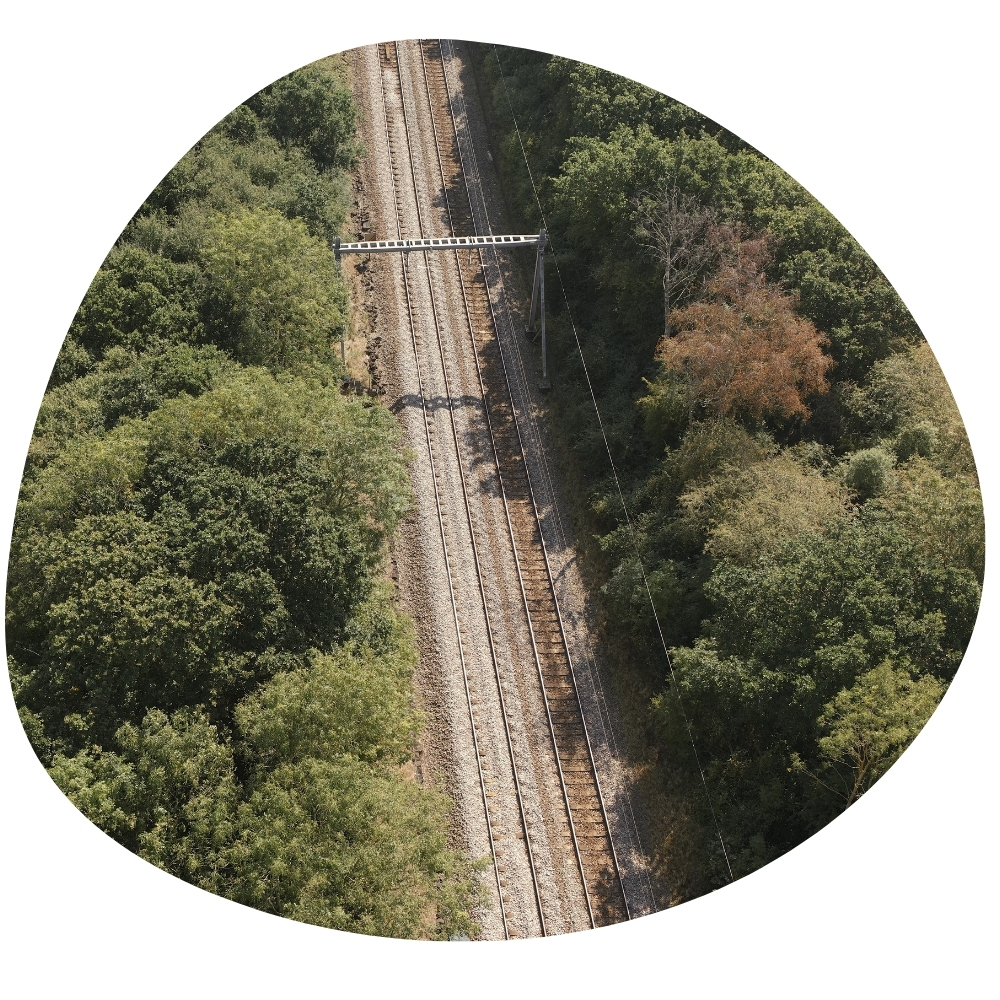
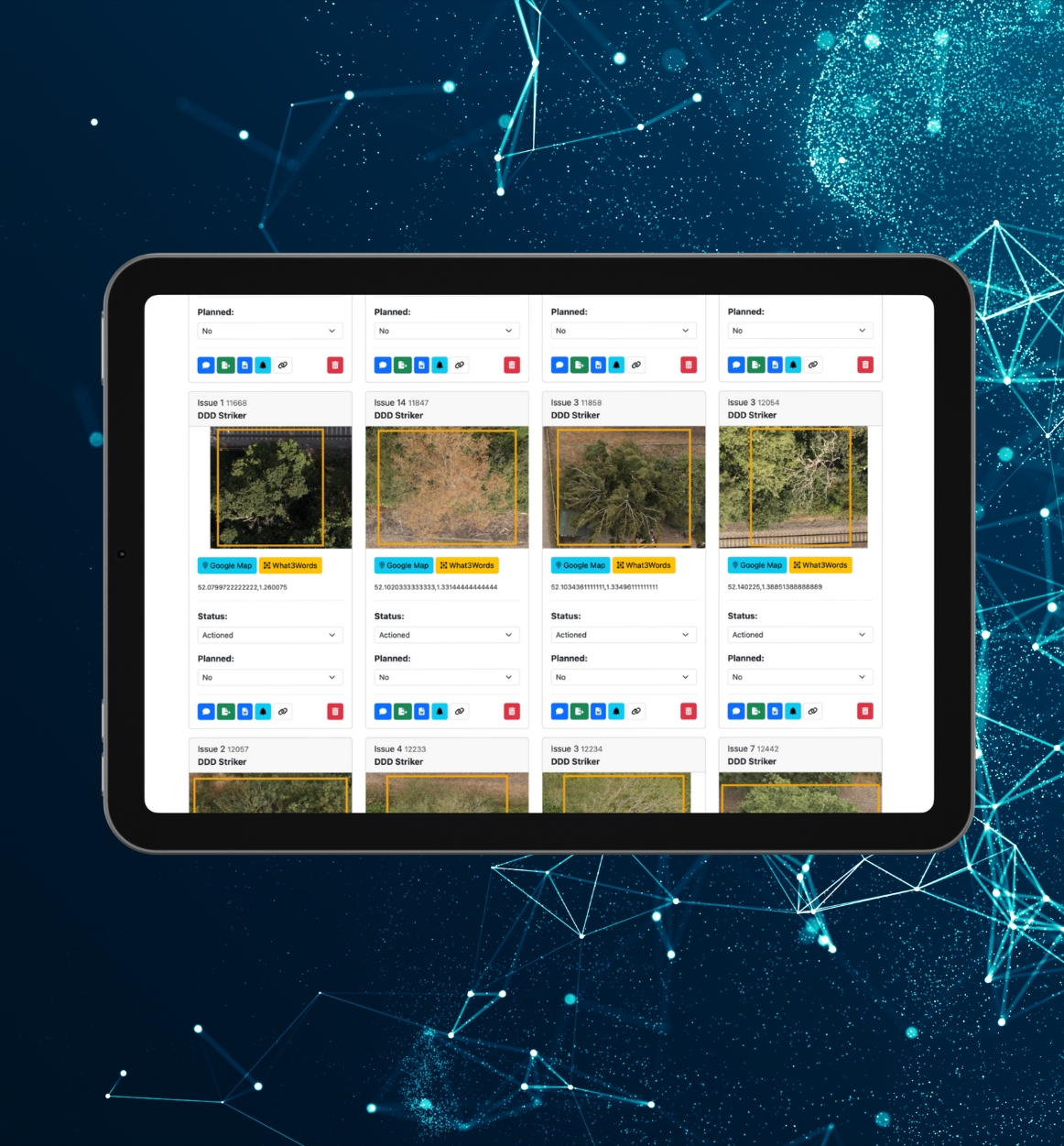
Tree Risk Recording
Our intuitive approach helps identify your risk trees.
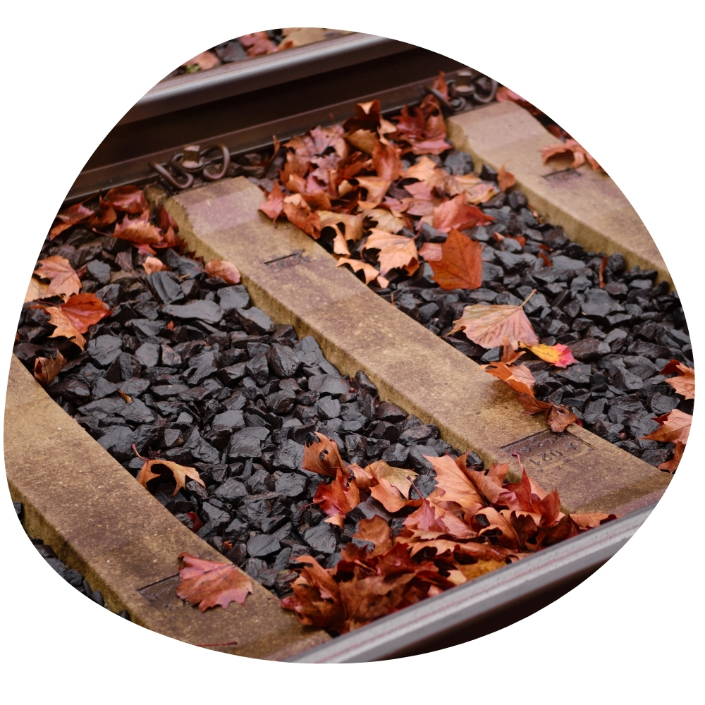
Leaf-Fall Scoring
High-resolution footage and meta data allows analysis of leaf fall.
Third-Party Trees
Manage and evidence assurances of third-party within DroneArb.
Categorisation
Real-time calculations of route risks broken down by categories.
Targeted Risk
We provide accurate coordinates to risk trees in multiple formats.
Compliance
Ability to provide precise reports for individual areas, including KPIs.
-
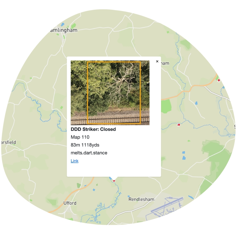
 Geo-Tagged Imagery
Using meta embedded imagery ensures optimal risk identification, whilst providing resourceful planning data that is accessible 24/7.
Geo-Tagged Imagery
Using meta embedded imagery ensures optimal risk identification, whilst providing resourceful planning data that is accessible 24/7.
-
Elevation
Accurate elevation provides the ability to record risks that are threats to people, assets and infrastructure.
-
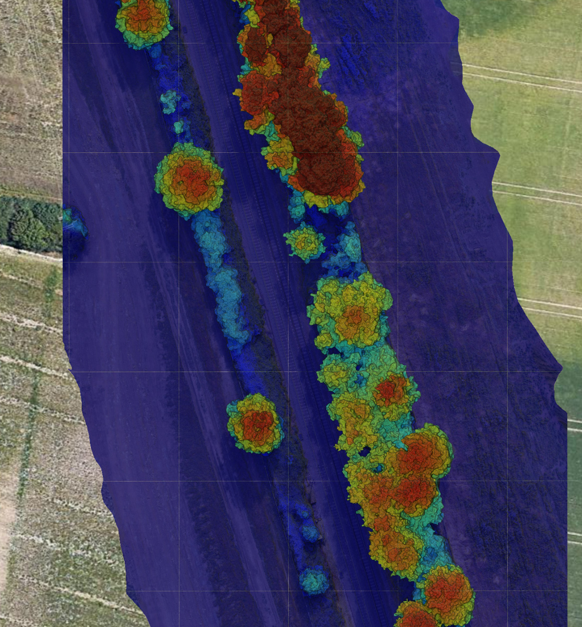
 Plant Health Algorithm
Our algorithm enables DroneArb to detect tree decline before it becomes visible, significantly enhancing prevention efforts through this proven method.
Plant Health Algorithm
Our algorithm enables DroneArb to detect tree decline before it becomes visible, significantly enhancing prevention efforts through this proven method.
Our Software is built from the Ground Up
The DroneArb software is a one-stop shop to manage risk trees, providing several automated features.
- Manage individual risk trees by annotating status change, general comments and uploading before and after photos.
- Real-time Matrix of all risk trees with multiple filtering options.
- Automated Reports of individual trees with meta enriched high-resolution imagery, and What3Words coordinates.
- Complete overview of entire route, or individual ELR's.
- Real-time charts showing MDU’s progress in addressing risk trees.
Other Uses for our
Technology
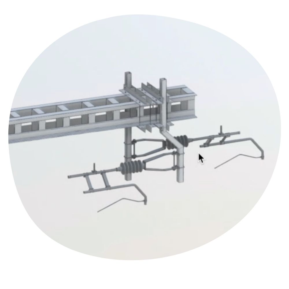
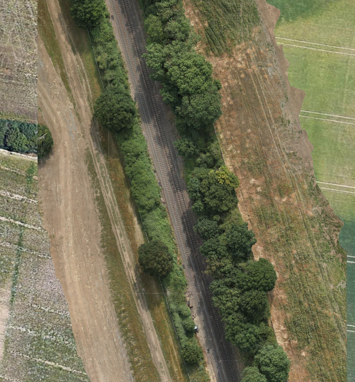
Over Head Lines
We inspect overhead lines (OLE) without setting foot on the ballast, delivering accurate data that can be transformed into 3D models, CAD models, and precise drawings.
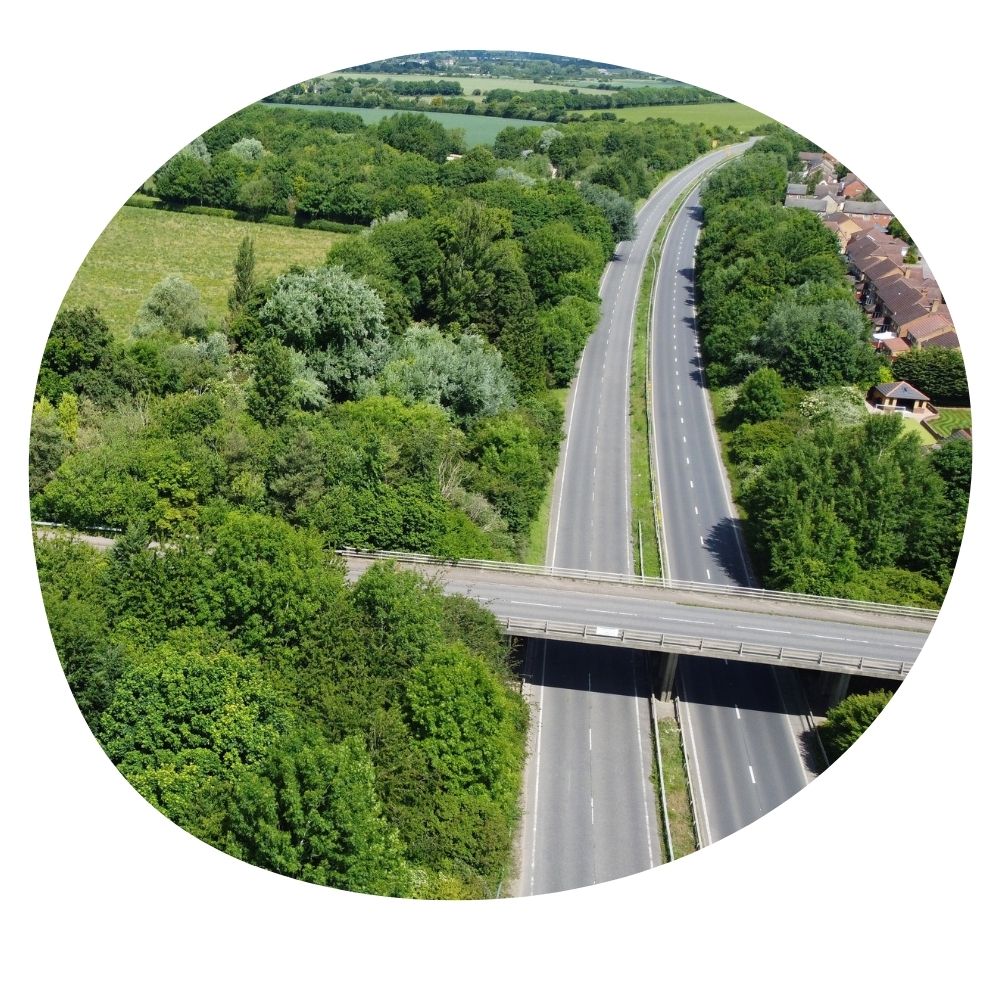
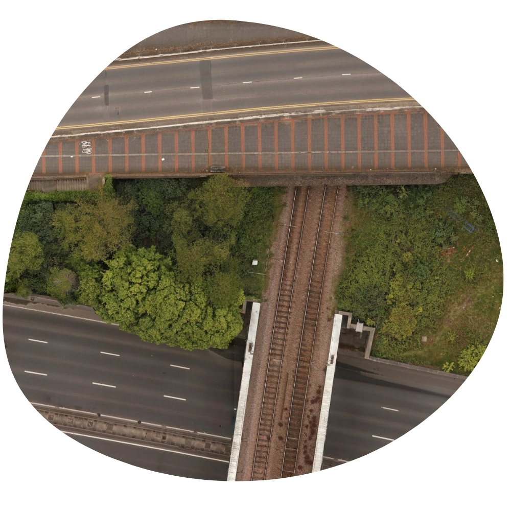
Highways
Monitoring highway risks, such as tree hazards, by survey aerial footage. This data helps identify potential threats, enabling timely maintenance and ensuring road safety.
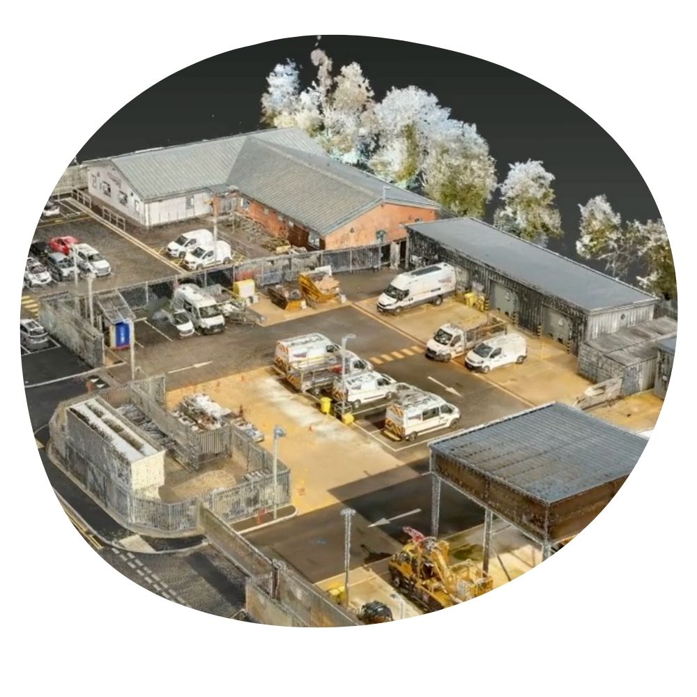
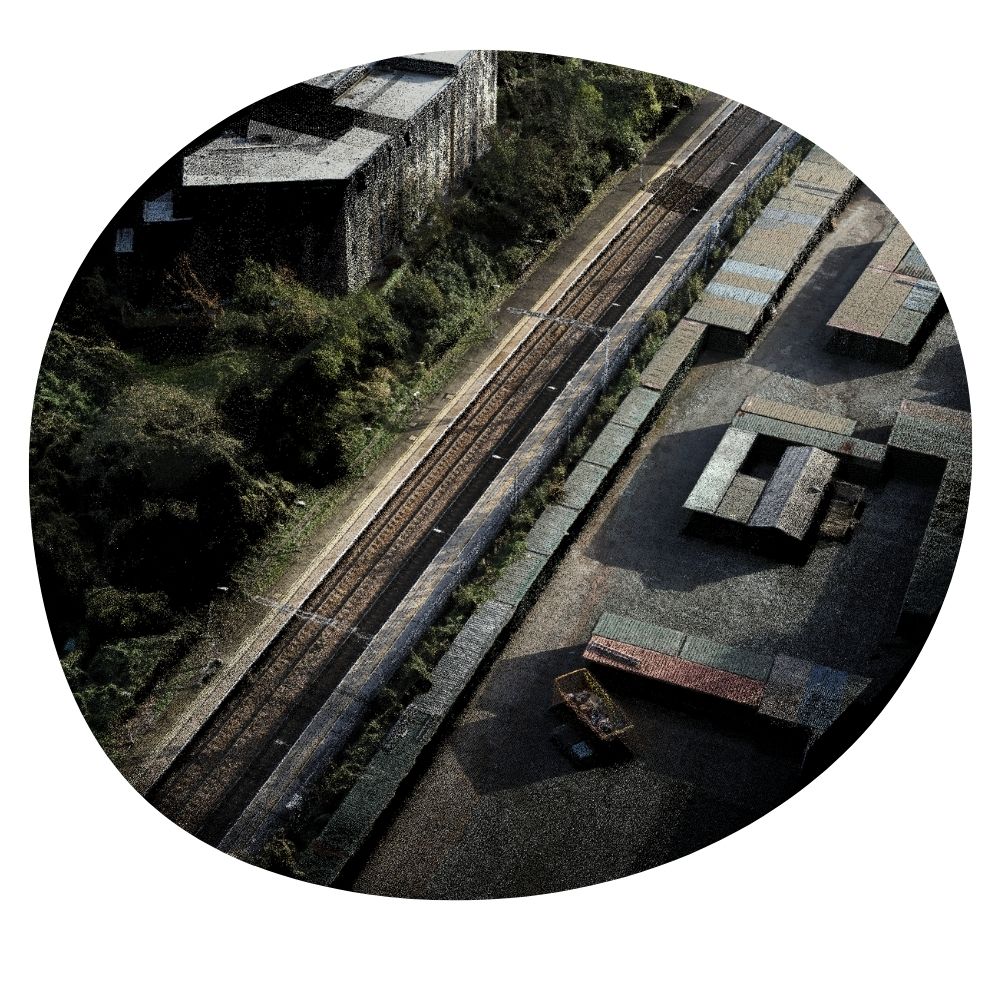
Digital Twins
This information allows for accurate, real-time virtual replicas, enhancing planning, construction, and maintenance processes through precise, efficient monitoring and analysis.
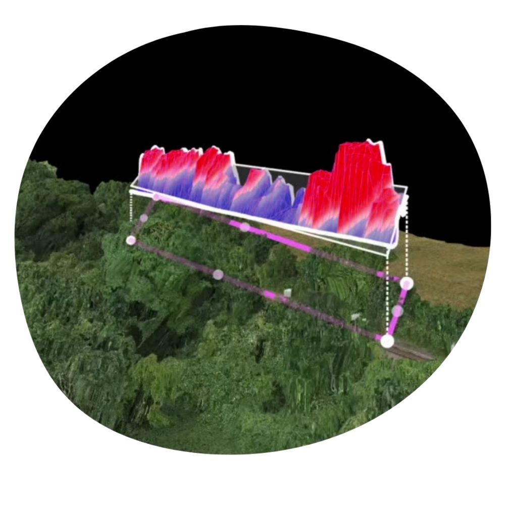
45-Degree Cut
We calculate the non-compliant vegetation by measuring the excess above the 45-degree cut using our specialist 3D modelling tool rendered from our advanced drone footage.
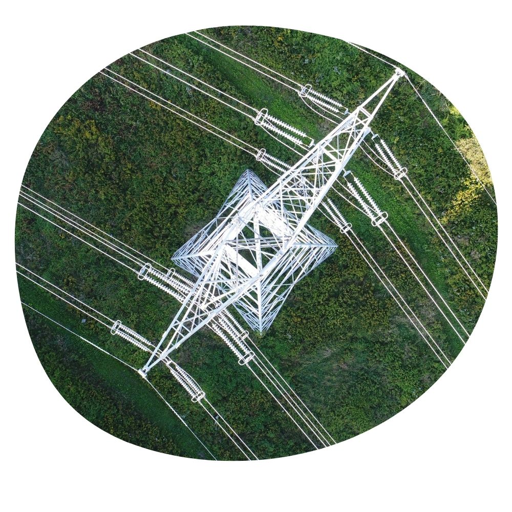
Powerlines
Capability to inspect powerlines efficiently, capturing high-resolution images and data to detect faults, ensure safety, and perform maintenance without disrupting service.
Land Monitoring
The ability to capture precise aerial data to detect shifts, landslides, or subsidence, providing crucial information for safety and preventative measures.
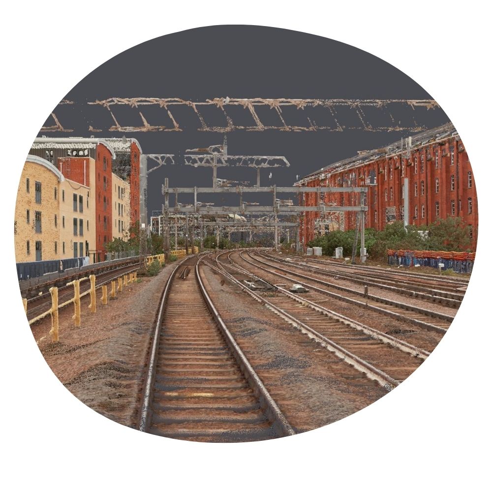
Track View
Our unique rendering capabilities can generate track or cab views from our drone footage without needing third-party hardware installation, or maintenance and boots on ballast, ensuring efficiency.
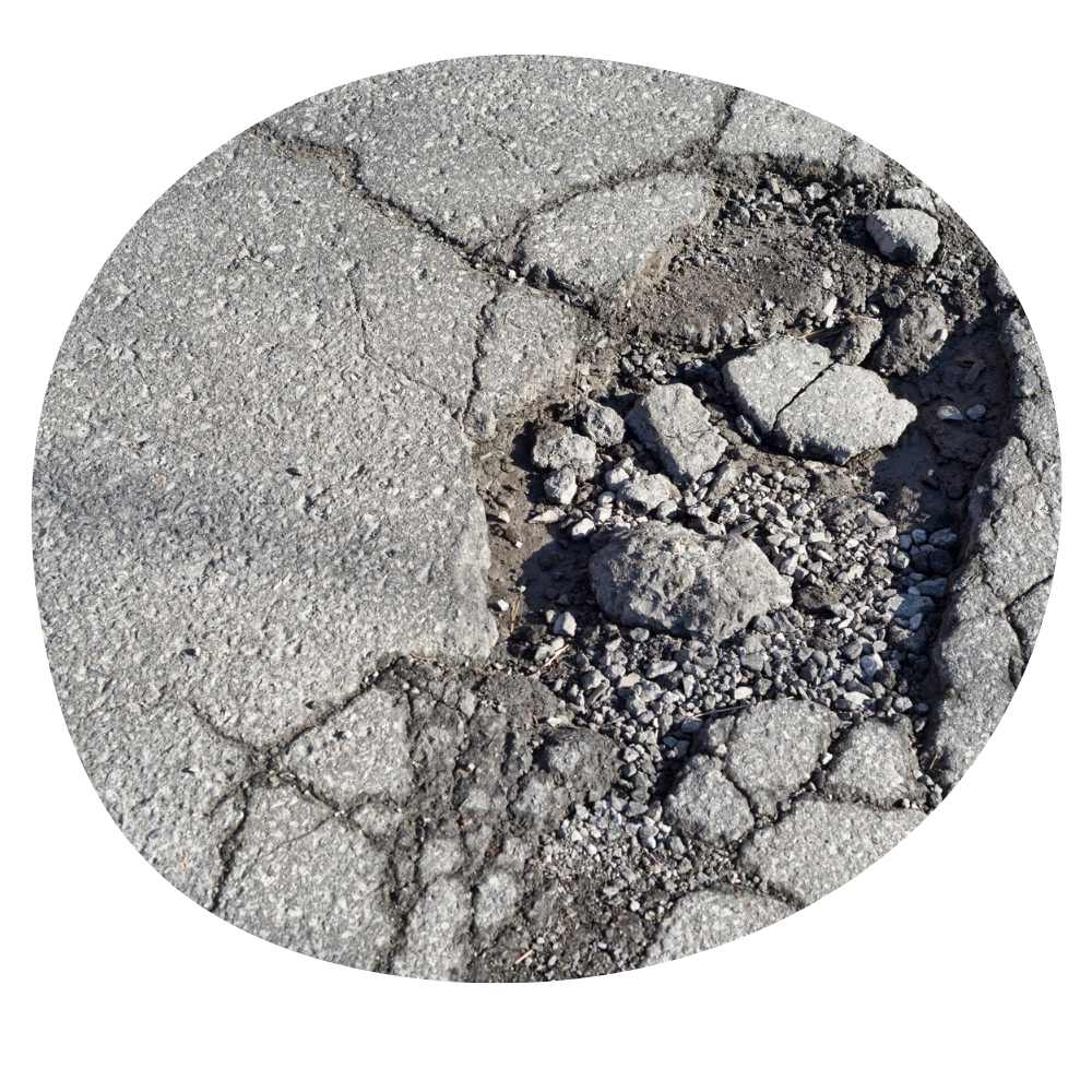
Road Condition
Our advanced aerial 3D model footage enables precise road condition surveys, identifying surface defects and deterioration with unparalleled accuracy, reducing the need for on-site inspections.
Want to discuss DroneArb?
If you would like to discuss DroneArb and its capabilities, please email the address below.
[email protected]